
Newburgh’s First Natural Resources Inventory Goes Public, Dedicated to Peter Smith
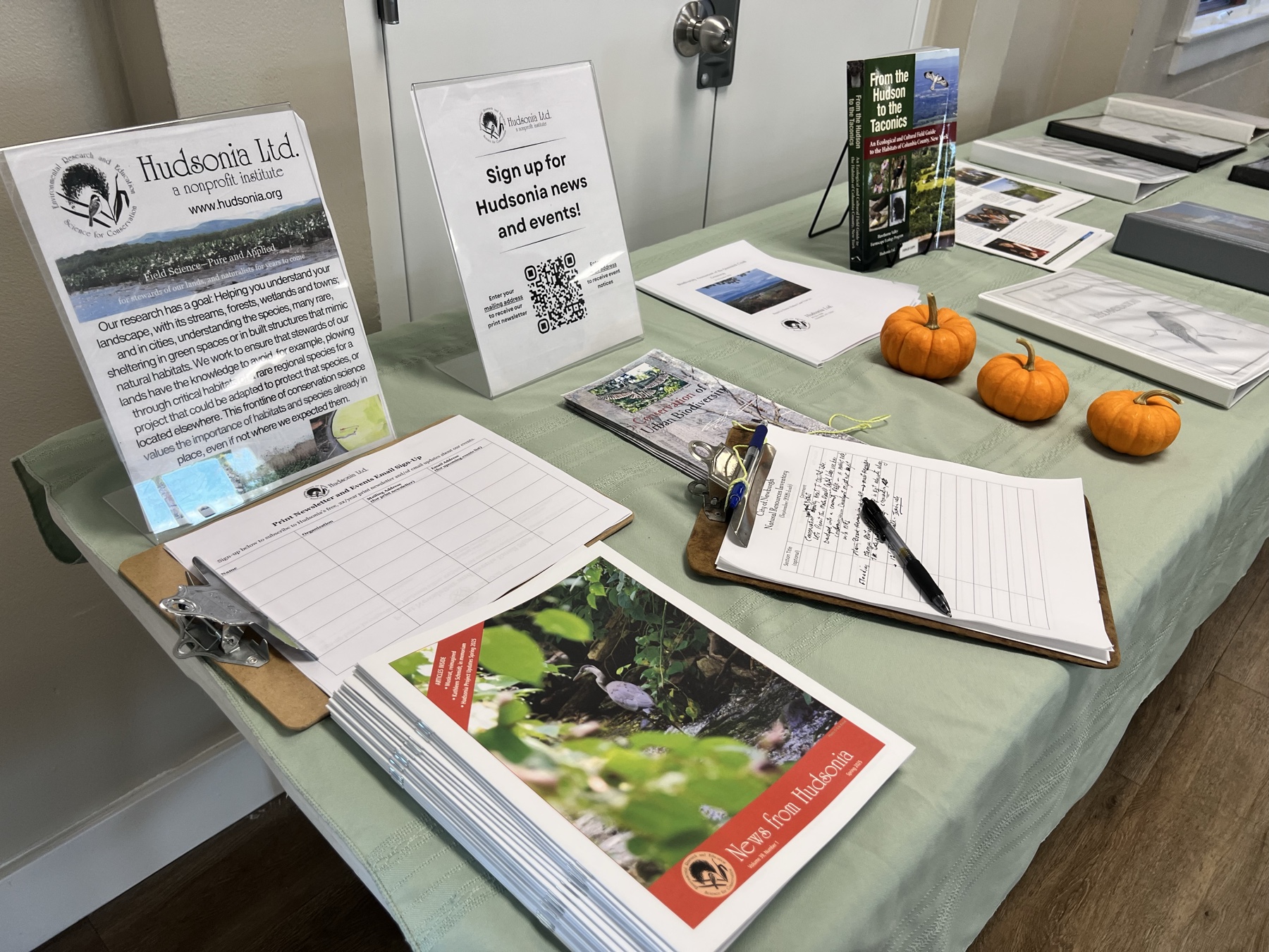
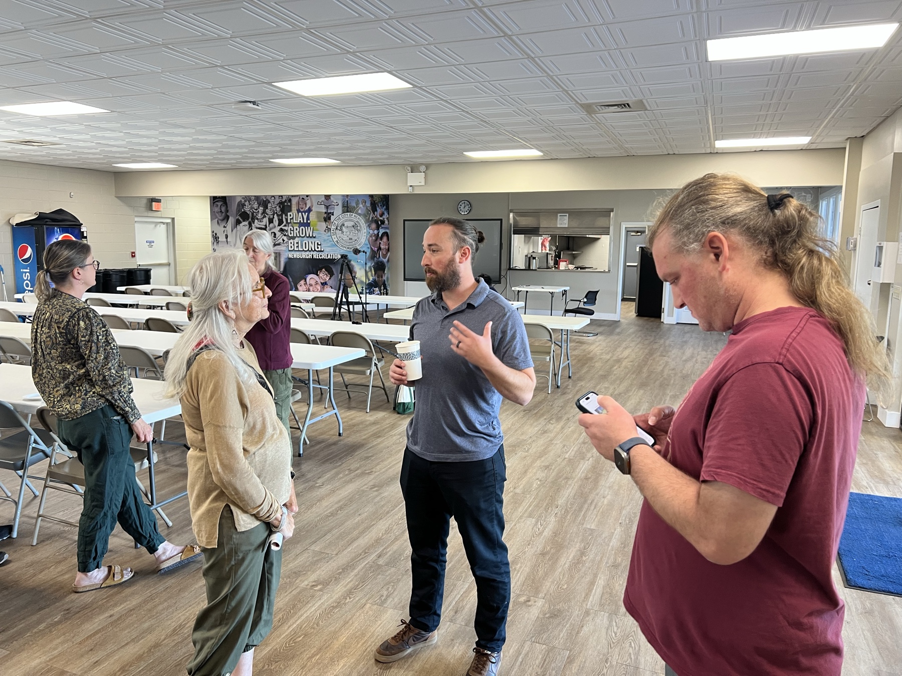
On Saturday, October 3, the City of Newburgh held a public workshop at the Activity Center on Washington Street on its first Newburgh Natural Resources Inventory. The draft maps the city’s forests, creeks, parks and flood zones, and the blocks that get hottest in summer.
The draft runs 229 pages. Hudsonia Ltd. and GREENPLAN, Inc. prepared it for the City. It is dedicated to the memory of Peter Smith, the architect and watershed advocate whose work we have written about in our coverage of Newburgh’s water and land. The City Council has not adopted it yet.
We filmed the workshop. You can watch the presentation here, with English and Spanish captions.
What a Natural Resources Inventory is
A natural resources inventory, or NRI, describes a place’s natural features and explains why they matter to people and to ecosystems. It is not a law. The draft says its recommendations “do not obligate the City or other users to particular courses of action.”
Newburgh’s NRI covers the city and the watersheds of Washington Lake and Browns Pond, the sources of the City’s former and backup water supply. Work began in fall 2023. It grew out of a 2022 application by the City’s Conservation Advisory Council for a NYS Hudson River Estuary grant. Rep. Sean Patrick Maloney, Sen. James Skoufis, Assemblymember Jonathan Jacobson, Orange County Planning, City Historian Mary McTamaney and Outdoor Promise wrote letters of support.
What the draft found
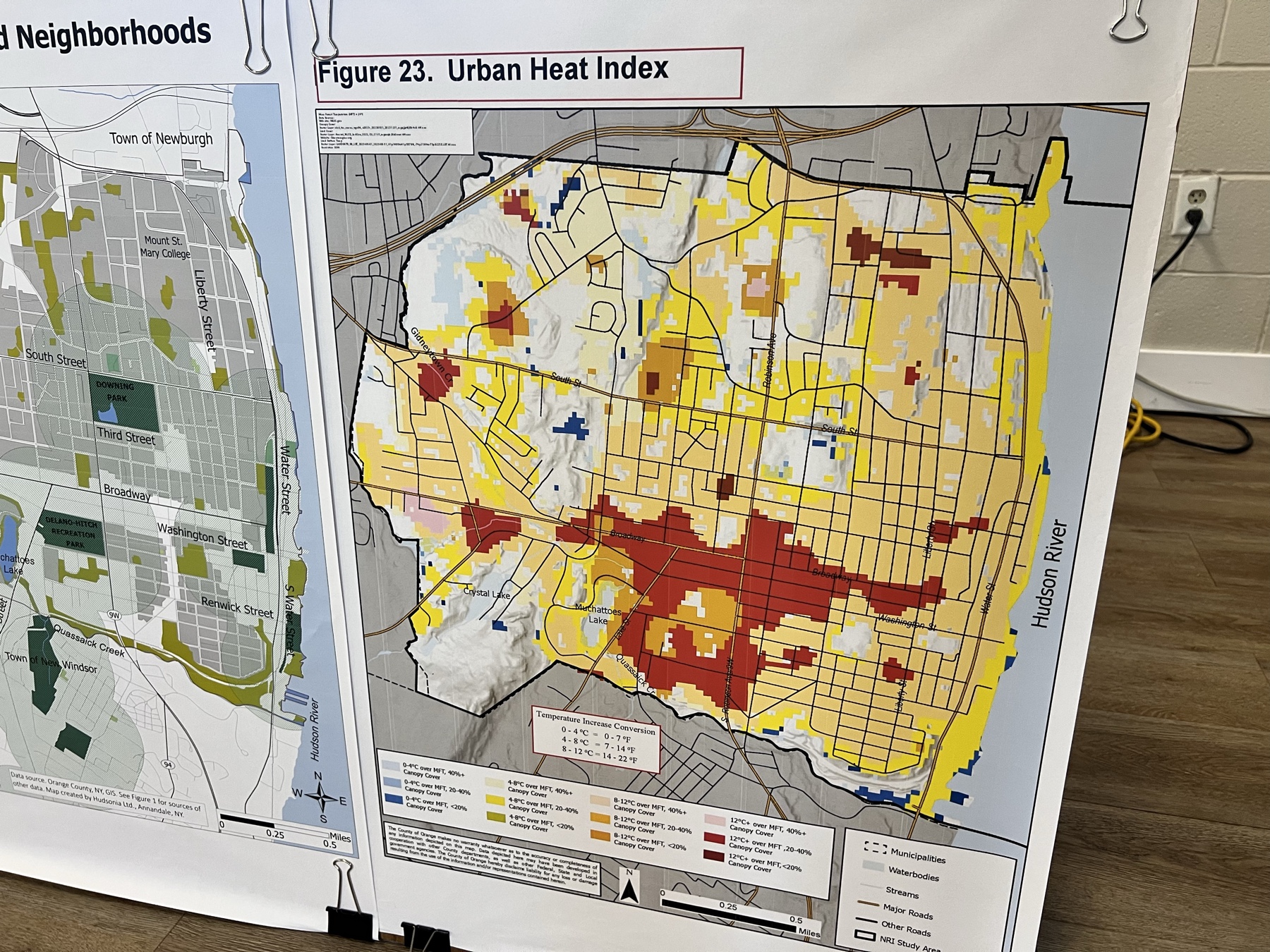
Trees. The draft calls the urban forest the most effective land cover for keeping water clean and the most practical way to cool neighborhoods. That means street trees, yard trees, hedgerows and larger woods. Its heat map, Figure 23, puts the hottest part of the city near Broadway, Lake Street and South Robinson Avenue. On that map, the hottest areas have the least tree canopy.
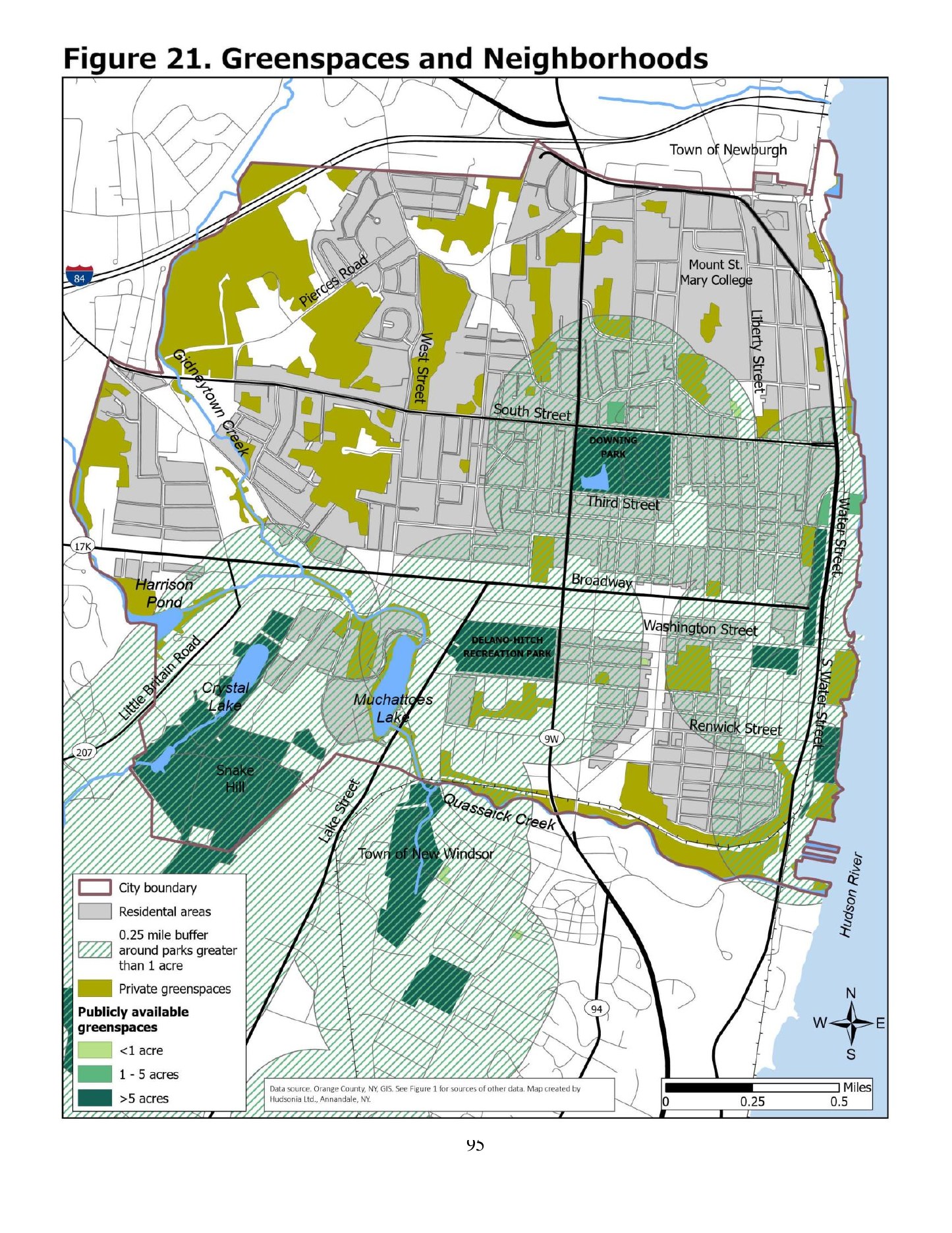
Natural areas and parks. The largest natural areas are the Hudson River, the City-owned land around Crystal Lake and Snake Hill, and private land in the western half of the city. Most parks and greenspaces are in the eastern and southern parts of town. The northwestern quadrant has the fewest within easy walking distance.
The public survey. A 2025 survey drew 128 responses, 97 of them from city residents. The top priority was maintaining existing parks (23 percent), followed by more and better walking and bike paths (17 percent) and better access to the waterfront (16 percent). New parks came first for 8.6 percent. The draft notes that respondents were older and whiter than the city as a whole, and says the results “should be interpreted through that lens.”
Flooding. The draft projects that more land along the Hudson, the Quassaick Creek and the Gidneytown Creek will flood or stay underwater in the coming decades. It recommends discouraging new development in the 100-year flood zones of both creeks and requiring sea level rise projections in applications for waterfront projects.
In memory of Peter Smith
The dedication page reads, in part:
“This Natural Resource Inventory is dedicated to the memory of Peter Smith. Peter was a resident of the City of Newburgh living on Montgomery Street, a Registered Architect, and devoted steward to the City. Peter served on the City’s Planning Board, Conservation Advisory Commission, Architectural Review Commission, and the Quassaick Creek Watershed Alliance. … It is fitting that this Natural Resource Inventory, created to support informed stewardship and future policy, carry Peter Smith’s name in remembrance.”
In 2009, Peter worked out that Washington Lake sits inside the Quassaick Creek drainage and began leading watershed tours for officials and residents. In 2011 he wrote the modeling findings for a green infrastructure plan at Cerone Place. In 2013 he presented a concept plan for a creek trail at Kaplan Hall. In 2017 he wrote Reclaiming Newburgh’s Other Waterfront, a planning primer on the Quassaick.
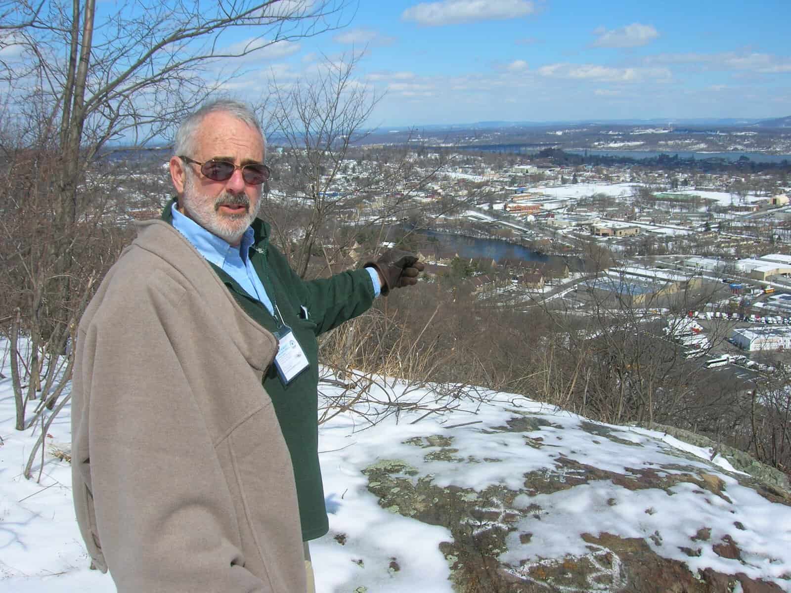
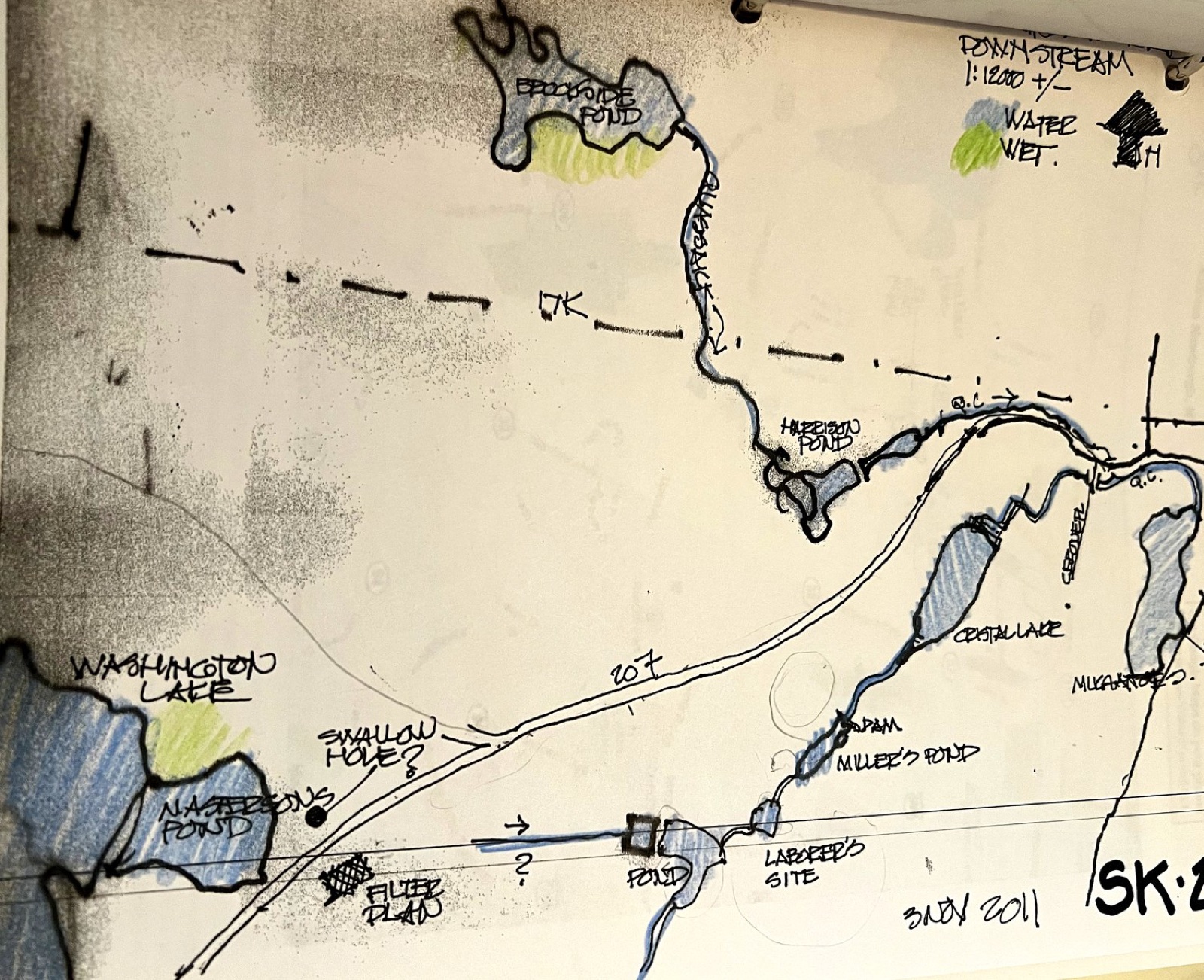
His field sketches of Washington Lake and the waters below it are printed in our Newburgh’s Water: Flowing Through Time booklet.
What was said on October 3
Gretchen Stevens, Director Emerita of Hudsonia’s Biodiversity Resources Center, led the presentation and spent much of it on trees. “Even if it’s just some trees lining a street with concrete all around, they do a lot to reduce the air temperature in the vicinity of those trees,” she said. “The benefits they provide to the people living here and working here, I think are immeasurable.”
She also explained what the recommendations are. “These recommendations do not obligate the city to do any particular thing,” she said. “These are just ideas for how to move forward with protecting the important natural resources that are here now.”
Ingrid Haeckel, manager of the DEC’s Hudson River Estuary Program, which funded the work, called natural resource inventories “a foundational planning document that help communities understand their important land and water resources and what they can do to protect them.”
Kippy Boyle, a former member of the Conservation Advisory Council, said after the presentation: “I’m really hoping that our planning board will use this as a regular tool when they review site plans.”
Ronald Zorrilla of Outdoor Promise, who wrote the 2022 grant application with Conservation Advisory Council Chair Chuck Thomas, spoke at the end. “People don’t really talk about biodiversity and things like that, but they do talk about their health,” he said. “They do talk about wanting places for their kids to spend time, and if we don’t catalog what we have, and if we don’t let people experience what we have, we don’t protect it and we lose it.”
Who made it
The NRI is a City of Newburgh project, directed by the Department of Planning and Development and the Conservation Advisory Council. City Planner Jonathan Midler oversaw it for the City. Hudsonia biologists Gretchen Stevens and Amanda Bevan-Zientek and GREENPLAN planner Ted Fink compiled the information and wrote the text. Orange County Planner Jessica Ridgeway created the Urban Heat Index map. Greater Newburgh Parks Conservancy Director Kathy Lawrence and the 2024 Environmental Justice Fellows helped prepare the public survey.
The New York State Environmental Protection Fund paid for the work through the Hudson River Estuary Program of the NYS Department of Environmental Conservation, where Ingrid Haeckel oversaw the project. The Steering Committee is listed on newburghnri.org.
What This Means for Newburgh
For the first time, one document shows where the trees are, which blocks run hottest, which homes are more than a 10-minute walk from a park, and where the water will rise. The draft also proposes ways to measure equity. They include the share of residents within a 10-minute walk of a park, tree canopy by neighborhood, and rates of preventable hospitalizations. Those rates are 213.3 per 10,000 adults in the city and 126.4 in the rest of Orange County.
Its recommendations include:
- Planting at least two new trees for each one that must be cut for new or expanded land uses
- A source water protection program for the Washington Lake and Browns Pond watersheds, run jointly with the towns of New Windsor and Newburgh
- A public foot trail along the Quassaick Creek once infrastructure work there is finished
- Continued removal of abandoned dams
- A Community Preservation Fund to buy and maintain parkland
None of this binds the City until the inventory is adopted. The draft lays out three ways to do that: a Council resolution, a local law, or adding it to the City’s master plan, Plan-It Newburgh. The next step is a final document for the City Council to consider.
How Outdoor Promise Is Responding
Our part in the NRI was community engagement, as we said it would be in our 2022 support letter. At Quassaick Creek Fest on September 27, 2025, we ran the NRI park survey tables at Crystal Lake, and our REP Nature Leaders collected responses from residents. The draft uses our photos of a South Miller Street tree planting, a winter hike and the summit view on Snake Hill, kayakers at the mouth of the Quassaick, and the trash line at Muchattoes Lake before a cleanup. Its acknowledgments credit us with introducing the authors to parts of the city.
The draft asks the City to “continue partnering with organizations such as Outdoor Promise, the Greater Newburgh Parks Conservancy (GNPC), and the affiliated Environmental Justice Fellows.” We plan to. We will also publish shorter pieces on what the inventory found, starting with the urban forest and the heat map.
Take Action
- Read the draft. The City has posted the draft Natural Resources Inventory. The dedication is on page iii and the recommendations start on page 128.
- Follow the adoption. Public comments closed October 23. Watch the City Council and Conservation Advisory Council agendas for the adoption resolution.
- Come out with us. Our free community adventures visit Snake Hill, Crystal Lake and the Quassaick.
- Stay in the loop. Sign up for our newsletter for the NRI series and upcoming hikes.
Sources: City of Newburgh, draft Natural Resources Inventory (June 26, 2026 public draft); newburghnri.org; Hudsonia Ltd.; NYSDEC Hudson River Estuary Program; Outdoor Promise recording of the Oct 3, 2026 workshop; Outdoor Promise, Ten Years After Washington Lake; Outdoor Promise, Newburgh’s Water: Flowing Through Time.
This post is also available in:
